Book a demo with us at a time and place to suit you.
Out of stock
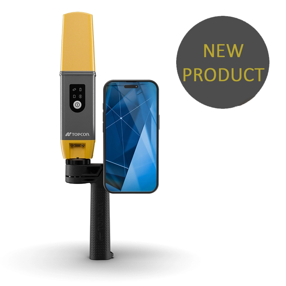
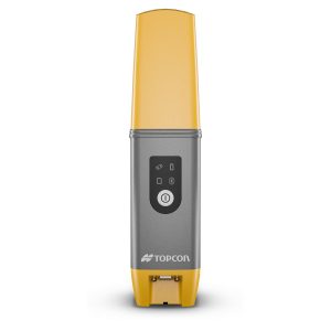
The Topcon CR-H1 is a handheld reality capture solution that combines RTK GNSS accuracy, photogrammetry and augmented reality (AR) into a single, easy-to-use workflow.
Designed for construction, surveying and engineering teams, the CR-H1 allows anyone – not just surveyors – to capture accurate point clouds and 3D data quickly and efficiently, using familiar mobile-based tools.
The CR-H1 delivers centimetre-level accuracy point clouds by combining:
Topcon HiPer CR GNSS technology
RTK corrections via Topnet Live or compatible services
PIX4Dcatch mobile photogrammetry on an iPhone Pro / Pro Max
PIX4Dcloud for processing, sharing and analysis
This integrated approach removes the barriers traditionally associated with 3D capture, making high-quality spatial data accessible to more people on site
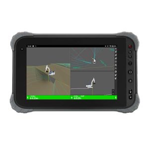
One of the CR-H1’s standout capabilities is real-time AR visualisation. Users can overlay digital designs directly onto the real world, helping teams:
Verify designs on site
Identify clashes or issues early
Communicate intent clearly with stakeholders
This reduces misunderstandings, rework and delays — particularly on complex or fast-moving projects
The CR-H1 is designed for everyday site use:
Lightweight, ergonomic handheld design
Mounted iPhone for intuitive data capture
Can also be mounted on a standard GNSS pole for precise single-point measurements
Fast setup with minimal training required
This flexibility allows teams to switch easily between handheld scanning and GNSS point measurement as required
Centimetre-level accurate point clouds using RTK
Anyone can capture data – not limited to surveyors
AR tools to visualise and verify designs on site
Cloud-based collaboration via PIX4Dcloud
Faster data capture and reduced project timelines
Portable, site-ready design for daily use
The Topcon CR-H1 is ideal for:
Construction progress capture
As-built documentation
Utilities and infrastructure recording
Site verification and inspections
Design validation and clash checking
Rapid reality capture in constrained environments
By combining GNSS accuracy, mobile photogrammetry and cloud workflows, the CR-H1 enables teams to work smarter, reduce reliance on specialist resources and make better decisions from accurate, up-to-date site data.
Available from JB Survey with expert advice, configuration support and aftersales service.
| RTK Precision | H: 10mm + 0.8 ppm
V: 15mm + 1 ppm |
| Weight | 650g |
| Compatibility | IOS version 16.0 or higher |

Common packages include CR GNSS receiver, Handheld mount, Pix4D Catch subscription and RTK License.
**The iPhone and case are not included in any of our package options and are pictured for example use only**
RTK corrections license available separately.
*£9,268 package includes CR receiver, 12m Pix4D Catch subscription, 12m Pix4D Cloud subscription, CR-H1 handle and soft carry case.
Please get in touch for other package options or a demonstration.
JB ServicePlus
Service Subscription Plans
Survey Equipment Hire
Our Full Hire Fleet
JB SurveyPlan
Hire Subscriptions
Registered in England & Wales: 02340409
VAT Registered: 492544328
Call Us: 03301281010
Email Us: sales@jbsurvey.co.uk
Edenbridge, Kent
Basingstoke, Hamps
Milton Keynes, Bucks